Camping & ATV Riding in Montana
I enjoy taking in mountain scenery and a smooth ride much more than clawing
up a steep hillside.
So most of my riding is on forest service roads rather than trails. For that
reason, not one of these photos is taken where it would be dangerous to travel.
Technically ATVs on these roads should be Street Legal, but I have never seen
anyone enforcing those rules in Montana.
The ATV season for most of these areas is from July (Even sometimes July 15)
through October.
December through March, all of these same areas are great for Snowmobling.
Gravely Mountains near Yellowstone
The Gravlies main road runs 30 miles north to
south along the 8,000 ft central ridge.
Five access roads come up from the Ruby Valley on the west or the Madison
Valley on the east.
All these are good smooth roads, and offer beautiful vistas all the way.

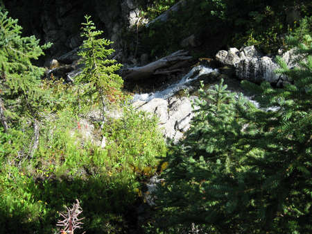
Riding Up Cottonwood Canyon
 .
.
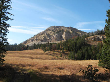
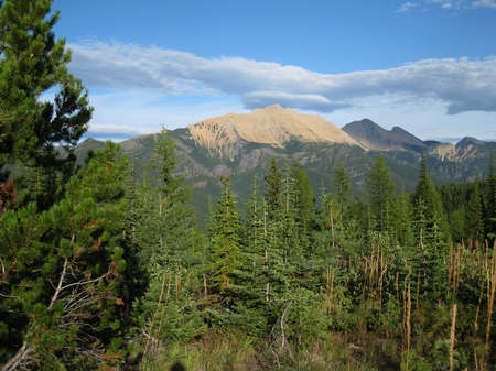
Red Hills north of Black Butte ...................................................The
View from Black Butte Cabin
Lionhead Area near Yellowstone
The Gallatin National
Forest has hundreds of miles of Jeep and ATV roads. I particularly enjoy the
Lionhead Area just west of West Yellowstone.
There is a 20 mile long ATV only loop road that nearly tops Lionhead Peak
and offers much above tree line riding.
 .
.
 .
.
Little Belt Mountains - Central Montana
I usually enter this great area by camping at
Kings Hill Pass on US 89 south of Great Falls.
From there you can ride northeast on the beautiful 8,000 ft Yogo Peak road
and even down toward Stanford if you wish.
Some of those roads get fairly rocky. Most of these roads are designated "Share
The Road", i.e.ATV/Jeep.
Or you can ride northwest or southwest around the Tenderfoot Valley. That
area is about 6,000 ft and a bit more wooded. It can get muddy.
Finally there is some great riding to the southeast towards Checkerboard
 .
.
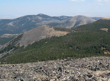
Baldly Peak 10,600
. .
.
From the top of Yogo Peak 8,800 ft
 .
.
The Tenderfoot area
Homestake Pass near Butte
The Deerlodge/Beaverhead National Forest maintains over
a hundred miles of fine ATV only roads in this area.
Because of the sandy soil the roads are exceptionally smooth. Most of them
are in open country.
This is old west country with old mines. Also the geology and rock formations
are really interesting.
I usually camp at Homestake Pass and ride mostly north of I-90, but also south.

Spire Rock
 .
.
 .
.
 .
.
Pioneer Mountains SW of Butte
This very scenic area is SW of Butte between Wise River and Polaris.
The Grasshopper campground is always popular with families because of its
close proximity to Elk Horn Hot Springs, and Crystal Park.
The whole family will enjoy digging quartz crystals, and exploring ghost towns,
followed by swimming in the hot pool.
Rides include nearly topping 10,000 ft Comet MT, and Lacy Creek areas ( The
Lacy to Pattengall ATV only is very rocky).
 .
.
My Camp in Pioneer Mountains .................................................The
old Elk Horn Mine town site
 .
.
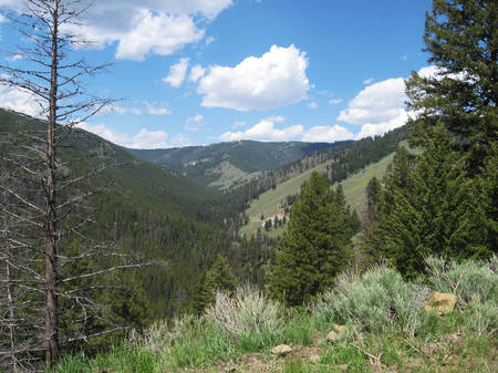
Lunch in a Beautiful Meadow.....................................................Up
On Comet Mountain 9,600 feet

Flathead
Country NW Montana
Here you are really in the Rocky Mountains. It is a lot more wooded in
this area, and you are more likely to find lakes and beautiful trout streams.
The Flathead National Forest is not as friendly towards ATV riding, however,
so you will have to stay on gravel or jeep roads.
The Hungry Horse Reservoir area offers some beautiful riding. However, the
best riding is in the Blacktail Mountain area SW of Kalispell.

Desert Mountain near Hungry Horse
 .
.
 .
.
Great Northern Mountain
 .
.
Blacktail Mountain Area
.
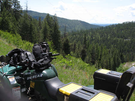
Bitterroot National Forest S of Missoula
Sadly most of this area burned in Aug 2011
This western
Montana national forest is friendly towards ATVers and has
hundreds miles of nice ATV only roads, as well as several hundred more Jeep
roads.
It is an excellent area for camping and ATV riding. I usually camp at Painted
Rocks State Park.
From there you can ride south to Woods Creek (Paved). Three mile south of
there, at Sheep Creek, starts a beautiful 40 mile long ATV only trail FSR
5685.
Or you can ride a circle route that heads west up FSR 5669 & 5665 to Woods
Creek Pass on the Montana/Idaho Border.
From there you can take a side trip into Idaho to Horse Creek Hot Springs,
where you can soak in a natural hot springs (free).
Then after returning to the pass go SE along the MT/ID state line to Horse
Creek Pass.
Finish your trip by going down Beaver Creek and West Fork of the Bitterrroot
to the beginning.
Also, just south of Painted Rocks Lake on FSR 5703 are a number of seasonal
ATV only road. I have not driven them, but hear they are great.
 .
.
Woods Creek Road
 .
.

The Hot Springs
 .
.
Along the State Line road.........................................................Elk
are often seen on these roads
 .
.
Along the 40 mile ATV only Road (closed in the fall)
Kootenai National Forest: The Thompson Lakes area
This area is located about 50 mile west of Kalispell on US Hiway 2

This area is a mixture of land owned by Weyerhauser Lumber Co and Kootenai
National Forest.
We sincerely thank Weyerhauser for allowing the public on many of their roads
(Always respect their closed roads).
Many of the pictures shown below were taken on the mountains in the picture
shown above.
There are five beautiful campgrounds on the Thompson Lakes chain, most with
camping right on the lake.
Some of them are State while some are Federal.
Some of my favorite roads are: The 45 mile loop starting on the Boiling Springs
Road and then circling west along Indian Creek, and back north; or The Burnum
Creek Road,
or The 25 mile loop starting along Elk Creek and turning east on the Davis
Creek connection road to Davis Creek; and finally the Meadow Creek Road.
 .
.
 .
.
. .
.
The road up to Meadow Peak is rocky, but good and the views from there
are truly spectacular.
 .
.
. .
.
.
She would not move off the trail, so I decided this was where I would turn
around.

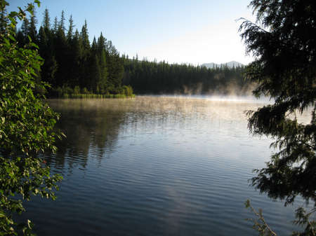
This was taken from my camp site one cool morning.
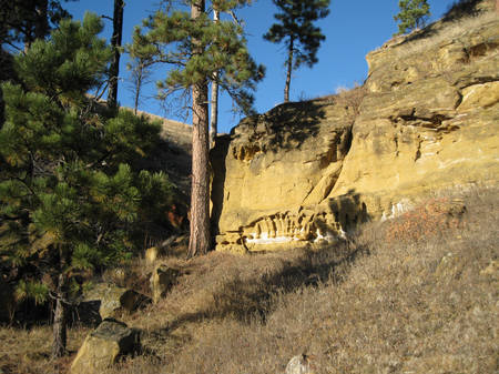
Custer National Forest far SE Montana
This
small National Forest offers some very interesting geological features along
its 50 miles of jeep roads.
 .
.
 .
.

.